Isometric
Paris
Haussmann boulevards, zinc rooftops and the Seine winding past the Eiffel Tower and Notre-Dame: Paris is a city-builder’s dream in isometric.
Made by Sam · tiny.paris · Nov 2026
All of Paris plus La Défense, 109,000 buildings and growing: OpenStreetMap and IGN building data with 50 cm LiDAR roof heights, painted tile by tile with Gemini, with traffic, buses, métros and boats moving through it.

There are 3 isometric maps of Paris so far, using AI-drawn and drawn from open data and 3D diorama techniques. The first one appeared in Nov 2026.Updated
All 3 maps of Paris


Isometric Paris
Our own map: central Paris from OpenStreetMap, with cars, tour boats on the Seine, the Eiffel Tower sparkling on the hour, and a day and a night view.
Open dataisometriccities.com


Petit Paris (opens the map in a new tab)
A real-time 3D map of Paris inside the périphérique, built with Codex and Three.js from open building and street data and IGN elevation data. Explore the city, switch from day to night, drive a car or fly a plane with other players.
3Dpetitparis.app
Paris landmarks in pixels
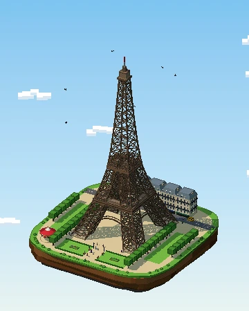
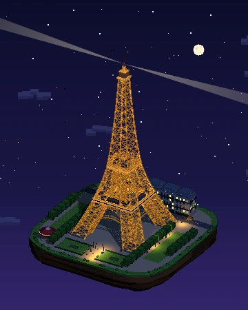
Our own pixel-art diorama of Eiffel Tower: a 3D island you can turn, from day to night.
Isometric Paris: questions
Is there an isometric map of Paris?
Yes — there are 3: Tiny Paris (tiny.paris) by Sam, Isometric Paris (isometriccities.com) by IsometricCities and Petit Paris (petitparis.app) by Pierre-Baptiste Borges. Each renders Paris in the style of classic city-builder games like SimCity 2000.
Who made the isometric map of Paris?
Tiny Paris was made by Sam, Isometric Paris was made by IsometricCities and Petit Paris was made by Pierre-Baptiste Borges.
How was the isometric Paris map made?
Tiny Paris is AI-drawn: an image model turns aerial or satellite imagery into pixel-art tiles, which are stitched together into one giant zoomable picture. Isometric Paris is drawn from open data: the city is rendered with code from datasets such as OpenStreetMap building footprints and heights, rather than by an image model. Petit Paris is a 3D diorama: a real-time 3D scene of the city is viewed through an isometric-style camera, like a tiny model you can explore.
Is the isometric map of Paris free to explore?
Yes. All of them are public websites you can open in any browser for free — no account or download needed. Isometric Cities links to the originals; the maps belong to their creators.
Are there isometric maps of other cities in France?
Not yet — Paris is currently the only city in France with an isometric map. The nearest other cities with one are Brussels, Leuven and London.
How can I make my own isometric map of Paris?
Pick a technique — AI-drawn tiles from aerial imagery, rendering OpenStreetMap building data, or a 3D diorama — then publish it as a zoomable tile map. Our guide walks through all three, and you can submit your map to be listed here.