About Amsterdam canal houses
The Grachtengordel, Amsterdam’s canal ring, was one of the largest planned city extensions of its time. Work started in 1613, when the booming trading city outgrew its medieval walls, and the northwestern part was finished around 1625. The southern part followed after 1664. Three new residential canals were dug in half circles around the old centre, the Herengracht, Keizersgracht and Prinsengracht, with the Singelgracht as the new outer moat for defence and water management.
The canals were named with some ambition. The Herengracht is named after the heren regeerders, the regents who ruled the city; the Keizersgracht after Maximilian I, Holy Roman Emperor; and the Prinsengracht after the Prince of Orange. The Keizersgracht is the widest of the three, at about 28 metres. Rich merchants built their houses on the narrow plots along the water, with deep gardens behind them.
The houses are what make the canals famous. Most are narrow and tall, with a decorated gable on top. Step gables were the fashion in the first half of the 17th century; neck gables appeared around 1640, and the rounder bell gables followed from about 1660. Many have a beam with a hook at the top, used to hoist furniture and goods up the front, and some were built leaning slightly forward so the loads would not scrape the facade.
In 2010 the area was added to the UNESCO World Heritage List as the Seventeenth-Century Canal Ring Area of Amsterdam inside the Singelgracht, as an example of large-scale town planning that served as a model well into the 19th century. Today the canals are lined with elms, crossed by bikes on every bridge, and busy with tour boats, small rental boats and moored houseboats.
The diorama
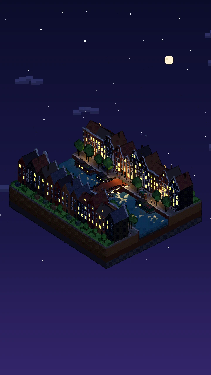
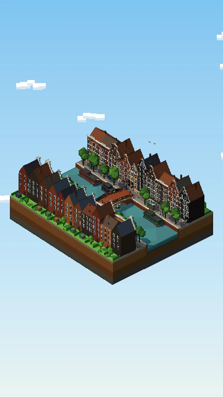
The diorama shows a stretch of canal on a floating island, built in Three.js and rendered as pixel art: the scene is drawn at a low resolution, every edge gets a dark outline, the colours are reduced to a small palette, and the result is scaled up without smoothing. The canal runs straight through the island and is cut open at both ends, so you see the water in section between the brick quay walls. A humpback brick bridge crosses it, with a stone arch ring, iron railings and a row of parked bikes.
Both quays are lined with narrow canal houses, each different: red, brown and black brick, white window frames, step, neck and bell gables with white trim, a few flat-topped cornice houses, hoisting beams with hooks, and a slight lean here and there. Elms and lamp posts stand along the water, houseboats are moored on one side, and a glass-roofed tour boat and a small rental boat cruise past. At night the windows light up, light bulbs trace the arch and the edge of the bridge, and their reflections shimmer on the canal.
Things to spot
- Bulbs outlining the bridge arch at night
- Hoisting beams and hooks at the top of the gables
- A tulip stall on the quay
- Cyclists riding over the humpback bridge
- Roof gardens on the houseboats
- Rows of red-brown bollards along the pavement
What we simplified
- The houses are generic canal houses, not the actual buildings of any particular canal.
- The canal is narrower than the real Herengracht or Keizersgracht, so both rows of houses fit on the island, and it runs straight instead of curving.
- Real canal houses have deeper plots and longer gardens than the ones behind the houses here.
Questions
When were the Amsterdam canals built?
Amsterdam’s canal ring was laid out in the 17th century. Work started in 1613 and the northwestern part was finished around 1625; the southern part of the ring was built after 1664.
Why are Amsterdam canal houses so narrow?
The plots along the canals were narrow and deep, so houses were built tall and thin with gardens behind them. Many have a hoisting beam with a hook at the top, because furniture and goods were easier to lift up the front than to carry up the steep, narrow stairs.
Why do some Amsterdam houses lean forward?
Some canal houses were built leaning slightly forward on purpose, so that goods hoisted up the front would not hit the facade or the windows. A sideways lean is usually something else: the wooden foundations have settled or rotted over time.
Are the Amsterdam canals a UNESCO World Heritage Site?
Yes. The Seventeenth-Century Canal Ring Area of Amsterdam inside the Singelgracht was added to the UNESCO World Heritage List in 2010. It covers the Herengracht, Keizersgracht and Prinsengracht and the streets around them.
How was this pixel-art diorama of the Amsterdam canals made?
It is a real-time Three.js scene running on this page, drawn at 360 × 640 pixels with dark outlines and a small palette, then scaled up without smoothing. Each canal house is built from code with its own gable, colour and lean, and the bridge bulbs and window reflections switch on at night. Press “Explore in 3D” to drag it round and switch between day, dusk and night.
Isometric maps of Amsterdam
Amsterdam also has an isometric pixel-art map made by the community: the whole city drawn tile by tile in the same SimCity-like style. See the map of Amsterdam →